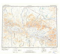
1950 Map of Mount Hayes
USGS Topo · Published 1955About this map
The Alaska Range dominates this mid-century reconnaissance, where glacial systems feed the powerful northern drainage of the Tanana River and the southward course of the Delta River. This 1950s documentation shows the vital overland corridors of the Richardson Highway and the Alaska Highway as they navigated a landscape defined by massive summits like Mt Hayes and Mt Kimball. For local historians and genealogists, the map preserves a network of essential interior outposts including Rapids Roadhouse and Millers Roadhouse, which served as critical stops for travelers and freight haulers in the era before modern infrastructure. These settlements, along with Paxson and Moochigan Lodge, reflect the logistical challenges of high-altitude habitation and the persistent human presence along the territory's early road system near the border of the Fourth Judicial Division and Third Judicial Division.
Find a feature on this map
57 named features on this map. Tap any name to fly to it.
Don’t see what you’re looking for? This feature index may not catch every label — zoom into the map to look around manually.
Map Details
Editions of this 1950 Mount Hayes Map
2 editions found

Other maps of this area

1948 · Tanacross A-6
USGS Topo · 1:63,360

1949 · Tanacross
USGS Topo · 1:250,000

1949 · Mount Hayes A-4
USGS Topo · 1:63,360

1949 · Gulkana D-3
USGS Topo · 1:63,360

1949 · Nabesna D-6
USGS Topo · 1:63,360

1949 · Big Delta A-6
USGS Topo · 1:63,360

1949 · Tanacross B-6
USGS Topo · 1:63,360

1949 · Fairbanks A-1
USGS Topo · 1:63,360

1949 · Healy A-1
USGS Topo · 1:63,360

1949 · Healy D-1
USGS Topo · 1:63,360