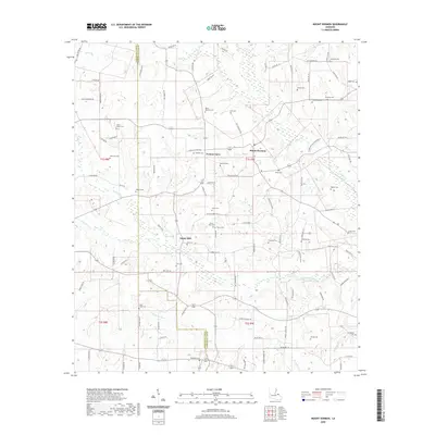
2020 Map of Mount Hermon
USGS Topo · Published 2020About this map
Mount Hermon and the surrounding piney woods of northern Louisiana are documented here at the border of Tangipahoa Parish and Washington Parish. The landscape is a network of small family settlements and namesake watercourses, notably the Tchefuncte River which drains the southern portion of the quadrangle. This area is characterized by an exceptionally high density of small family burial grounds, such as Henry Butler Cem, McElveen Cem, and Simmons Cem, providing an invaluable spatial record for genealogists tracing the early residents of these parishes.
Find a feature on this map
108 named features on this map. Tap any name to fly to it.
Don’t see what you’re looking for? This feature index may not catch every label — zoom into the map to look around manually.
Map Details
Editions of this 2020 Mount Hermon Map
This is the sole edition of this map. No revisions or reprints were ever made.
Other maps of this area

1939 · Sunny Hill
USGS Topo · 1:31,680

1939 · Clifton
USGS Topo · 1:31,680

1940 · Spring Creek
USGS Topo · 1:31,680

1942 · Wilmer
USGS Topo · 1:31,680

1949 · Bolivar
USGS Topo · 1:31,680

1950 · Franklinton
USGS Topo · 1:31,680

1953 · Natchez
USGS Topo · 1:250,000

1954 · Baton Rouge
USGS Topo · 1:250,000

1956 · Natchez
USGS Topo · 1:250,000

1956 · Baton Rouge
USGS Topo · 1:250,000