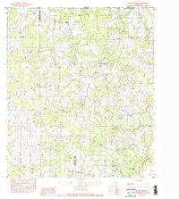
1983 Map of Mount Hermon
USGS Topo · Published 1984About this map
Mount Hermon and the surrounding pine-belt landscape of Washington Parish are documented in this early 1980s survey along the Louisiana-Mississippi border. The map reveals a deeply rooted rural community defined by a dense network of family cemeteries and small churches, such as Mt Olive Ch and James Chapel, reflecting the genealogical heritage of the area. The terrain is carved by numerous watercourses, including the headwaters of the Tchefuncta River and the winding Silver Creek, which bisect the timbered hills. Notable landmarks like the Sunny Hill Lookout Tower and Porters Curve provide navigational anchors in a region where the economy is closely tied to the land. The proximity to Pike Co, Mississippi, is evident along the northern boundary, showing how local roads and settlements like Sunny Hill integrated across state lines during this period of rural development.
Find a feature on this map
46 named features on this map. Tap any name to fly to it.
Don’t see what you’re looking for? This feature index may not catch every label — zoom into the map to look around manually.
Map Details
Editions of this 1983 Mount Hermon Map
This is the sole edition of this map. No revisions or reprints were ever made.
Other maps of this area

1939 · Sunny Hill
USGS Topo · 1:31,680

1939 · Clifton
USGS Topo · 1:31,680

1940 · Spring Creek
USGS Topo · 1:31,680

1942 · Wilmer
USGS Topo · 1:31,680

1949 · Bolivar
USGS Topo · 1:31,680

1950 · Franklinton
USGS Topo · 1:31,680

1953 · Natchez
USGS Topo · 1:250,000

1954 · Baton Rouge
USGS Topo · 1:250,000

1956 · Natchez
USGS Topo · 1:250,000

1956 · Baton Rouge
USGS Topo · 1:250,000