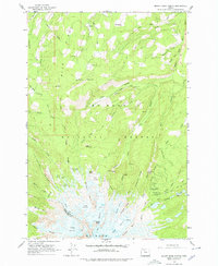
1962 Map of Mount Hood North
USGS Topo · Published 1979About this map
Cloud Cap Inn and the high-elevation administrative outposts of Tilly Jane Guard Station and Red Hill Guard Station anchor this 1962 survey of the northern slopes of Oregon's most famous peak. The landscape is defined by its massive ice fields, where Eliot Glacier, Ladd Glacier, and Glisan Glacier flow between dramatic ridges such as Cathedral Ridge and Stranahan Ridge. The map details the transition from the forested lower reaches of the Mount Hood National Forest to the alpine terrain of Wy'east Basin and the Langille Crags.
Find a feature on this map
64 named features on this map. Tap any name to fly to it.
Don’t see what you’re looking for? This feature index may not catch every label — zoom into the map to look around manually.
Map Details
Editions of this 1962 Mount Hood North Map
4 editions found
Other maps of this area

1924 · Mount Hood
USGS Topo · 1:125,000

1926 · Hood River
USGS Topo · 1:125,000

1927 · Mount Hood
USGS Topo · 1:125,000

1929 · Hood River
USGS Topo · 1:125,000

1953 · The Dalles
USGS Topo · 1:250,000

1956 · The Dalles
USGS Topo · 1:250,000

1957 · The Dalles
USGS Topo · 1:250,000

1957 · Bonneville Dam
USGS Topo · 1:62,500

1957 · Hood River
USGS Topo · 1:62,500

1962 · Cathedral Ridge
USGS Topo · 1:24,000