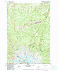
1962 Map of Mount Hood North
USGS Topo · Published 1992About this map
Mount Hood dominates this 1960s survey, revealing a landscape defined by its glacial systems and the early infrastructure of the Mount Hood National Forest. The map documents the northern glacial reach, including the Ladd Glacier, Coe Glacier, and Eliot Glacier, which carve out prominent features like Barrett Spur and Stranahan Ridge. Civil works and recreational outposts are clustered on the lower slopes, anchored by the Clear Branch Dam and Laurance Lake.
Find a feature on this map
67 named features on this map. Tap any name to fly to it.
Don’t see what you’re looking for? This feature index may not catch every label — zoom into the map to look around manually.
Map Details
Editions of this 1962 Mount Hood North Map
4 editions found
Other maps of this area

1924 · Mount Hood
USGS Topo · 1:125,000

1926 · Hood River
USGS Topo · 1:125,000

1927 · Mount Hood
USGS Topo · 1:125,000

1929 · Hood River
USGS Topo · 1:125,000

1953 · The Dalles
USGS Topo · 1:250,000

1956 · The Dalles
USGS Topo · 1:250,000

1957 · The Dalles
USGS Topo · 1:250,000

1957 · Bonneville Dam
USGS Topo · 1:62,500

1957 · Hood River
USGS Topo · 1:62,500

1962 · Cathedral Ridge
USGS Topo · 1:24,000