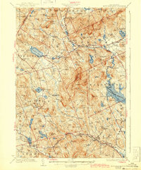
1928 Map of Mount Kearsarge
USGS Topo · Published 1943About this map
Mount Kearsarge anchors the center of this Merrimack County landscape, a dominant peak surrounded by the interconnected watersheds of the Blackwater River and Warner River. The area is defined by a dense network of early 20th-century villages and hamlets, many of which grew around the Boston and Maine railroad line. Industrial history is etched into the terrain at sites like Shingle Mill Corner, while the presence of numerous small local schools such as New Canada School and Cheney School indicates a decentralized rural society prior to mid-century consolidation.
Find a feature on this map
136 named features on this map. Tap any name to fly to it.
Don’t see what you’re looking for? This feature index may not catch every label — zoom into the map to look around manually.
Map Details
Editions of this 1928 Mount Kearsarge Map
5 editions found

Other maps of this area

1902 · Sunapee
USGS Topo · 1:62,500

1905 · Sunapee
USGS Topo · 1:62,500

1907 · Sunapee
USGS Topo · 1:62,500

1925 · Holderness
USGS Topo · 1:62,500

1926 · Hillsboro
USGS Topo · 1:62,500

1927 · Concord
USGS Topo · 1:62,500

1927 · Penacook
USGS Topo · 1:62,500

1927 · Holderness
USGS Topo · 1:62,500

1927 · Cardigan
USGS Topo · 1:62,500

1927 · Mascoma
USGS Topo · 1:62,500