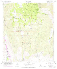
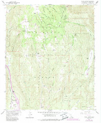
1960 Map of Mount Laguna
USGS Topo · Published 1977About this map
Mt Laguna Air Force Station and the Laguna Recreation Area anchor this mid-century survey of the high Laguna Mountains. The landscape is a network of remote family cattle operations including Laguna Ranch, Morris Ranch, and Crouch Ranch, connected by the winding Sunrise Highway and several jeep trails. The map documents early tribal land boundaries at the Cuyapaipe Indian Reservation and La Posta Indian Reservation, where a small cemetery and the Cuyapaipe Reservoir are noted.
Find a feature on this map
53 named features on this map. Tap any name to fly to it.
Don’t see what you’re looking for? This feature index may not catch every label — zoom into the map to look around manually.
Map Details
Editions of this 1960 Mount Laguna Map
5 editions found
Other maps of this area

1903 · Cuyamaca
USGS Topo · 1:125,000

1904 · Southern California Sheet No. 2
USGS Topo · 1:250,000

1931 · Carrizo
USGS Topo · 1:125,000

1939 · Campo
USGS Topo · 1:62,500

1942 · Potrero
USGS Topo · 1:48,000

1942 · Campo
USGS Topo · 1:62,500

1942 · Cuyapaipe
USGS Topo · 1:62,500

1942 · Cuyamaca Peak
USGS Topo · 1:62,500

1944 · Potrero
USGS Topo · 1:62,500

1944 · Cuyamaca Peak
USGS Topo · 1:62,500