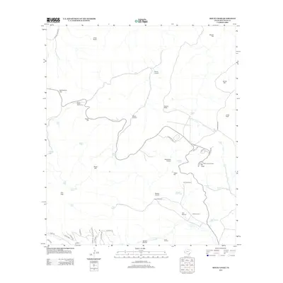
2012 Map of Mount Locke
USGS Topo · Published 2012About this map
McDonald Observatory sits atop Mt Locke, a focal point of this high-elevation landscape in the Davis Mountains during the early 21st century. The map illustrates a complex network of ranching and scientific infrastructure, with several functional landmarks like the Pete Trap Windmill, Salcido Windmill, and Limpia Windmill scattered across the terrain. These water sources, alongside numerous tanks such as Walker Tanks and Flat Tank, underscore the vital importance of water management in this arid region.
Find a feature on this map
61 named features on this map. Tap any name to fly to it.
Don’t see what you’re looking for? This feature index may not catch every label — zoom into the map to look around manually.
Map Details
Editions of this 2012 Mount Locke Map
This is the sole edition of this map. No revisions or reprints were ever made.
Other maps of this area

1894 · Valentine
USGS Topo · 1:125,000

1894 · Fort Davis
USGS Topo · 1:125,000

1897 · Valentine
USGS Topo · 1:125,000

1897 · Fort Davis
USGS Topo · 1:125,000

1943 · Valentine
USGS Topo · 1:125,000

1954 · Fort Stockton
USGS Topo · 1:250,000

1958 · Fort Stockton
USGS Topo · 1:250,000

1959 · Marfa
USGS Topo · 1:250,000

1965 · Marfa
USGS Topo · 1:250,000

1972 · Casket Mountain
USGS Topo · 1:24,000