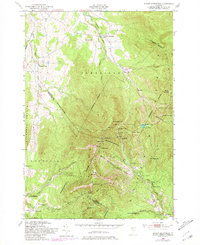
1948 Map of Mount Mansfield
USGS Topo · Published 1981About this map
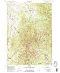
Mount Mansfield and the surrounding Mount Mansfield State Forest dominate this landscape, which straddles the boundary between Lamoille and Chittenden counties. This 1948 survey, updated with 1970s revisions, highlights the early infrastructure of Vermont's recreation economy, including the Toll Road, Toll House, and the State Ski Dormitory. High-altitude landmarks like The Chin, The Nose, and The Forehead define the ridgeline, which is traversed by The Long Trail. Below the summits, hikers and skiers can trace locations such as Taft Lodge, Butler Lodge, and Barnes Camp. In the lower elevations, small settlements and industrial markers like South Cambridge, Morses Mill, and the Harvey Sch reflect the rural community life that existed alongside the developing mountain tourism of the mid-20th century.
Find a feature on this map
55 named features on this map. Tap any name to fly to it.
Don’t see what you’re looking for? This feature index may not catch every label — zoom into the map to look around manually.
Map Details
Editions of this 1948 Mount Mansfield Map
6 editions found
Other maps of this area

1919 · Montpelier
USGS Topo · 1:62,500

1921 · Richmond
USGS Topo · 1:48,000

1921 · Montpelier
USGS Topo · 1:62,500

1924 · Camels Hump
USGS Topo · 1:62,500

1925 · Mount Mansfield
USGS Topo · 1:48,000

1927 · Mount Mansfield
USGS Topo · 1:62,500

1927 · Hyde Park
USGS Topo · 1:48,000

1930 · Hyde Park
USGS Topo · 1:62,500
1943 · Hyde Park
USGS Topo · 1:62,500

1944 · Montpelier
USGS Topo · 1:62,500