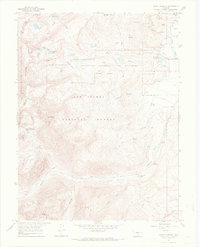
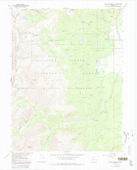
1967 Map of Mount Massive
USGS Topo · Published 1972About this map
Leadville National Fish Hatchery sits at the base of the high peaks, surrounded by a complex network of glacial hydrology and subalpine terrain. The landscape is dominated by the massive bulk of Mount Massive and Bald Eagle Mountain, with the Continental Divide marking the boundary between the White River and San Isabel National Forests. This 1960s record captures the industrial legacy of the high country, from the Carlton Tunnel and Siwatch Tunnel to the mining activity at Venture Shaft and various prospects scattered near Colorado Gulch.
Find a feature on this map
46 named features on this map. Tap any name to fly to it.
Don’t see what you’re looking for? This feature index may not catch every label — zoom into the map to look around manually.
Map Details
Editions of this 1967 Mount Massive Map
5 editions found
Other maps of this area

1889 · Leadville
USGS Topo · 1:125,000

1891 · Leadville
USGS Topo · 1:125,000

1909 · Mount Jackson
USGS Topo · 1:125,000

1911 · Mount Jackson
USGS Topo · 1:125,000

1935 · Mount Elbert
USGS Topo · 1:62,500

1938 · Mount Elbert
USGS Topo · 1:62,500

1939 · Mount Elbert
USGS Topo · 1:62,500

1942 · Leadville
USGS Topo · 1:125,000

1949 · Holy Cross
USGS Topo · 1:62,500

1951 · Holy Cross
USGS Topo · 1:62,500