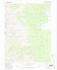
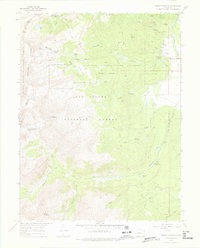
1967 Map of Mount Massive
USGS Topo · Published 1992About this map
Mount Massive dominates this high-altitude landscape of the Sawatch Range during the mid-1960s, a period when the area was managed for both conservation and industry. The presence of the Leadville National Fish Hatchery highlights the region's commitment to aquatic resource management, while the scattered Prospects and named industrial sites like the Venture Shaft and Prospect Mine point to a legacy of mineral exploration.
Find a feature on this map
49 named features on this map. Tap any name to fly to it.
Don’t see what you’re looking for? This feature index may not catch every label — zoom into the map to look around manually.
Map Details
Editions of this 1967 Mount Massive Map
5 editions found
Other maps of this area

1889 · Leadville
USGS Topo · 1:125,000

1891 · Leadville
USGS Topo · 1:125,000

1909 · Mount Jackson
USGS Topo · 1:125,000

1911 · Mount Jackson
USGS Topo · 1:125,000

1935 · Mount Elbert
USGS Topo · 1:62,500

1938 · Mount Elbert
USGS Topo · 1:62,500

1939 · Mount Elbert
USGS Topo · 1:62,500

1942 · Leadville
USGS Topo · 1:125,000

1949 · Holy Cross
USGS Topo · 1:62,500

1951 · Holy Cross
USGS Topo · 1:62,500