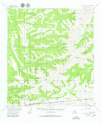
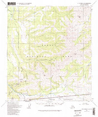
1954 Map of Mount McKinley C-2
USGS Topo · Published 1980About this map
Kantishna and the surrounding gold-bearing district are documented here during the mid-1950s, a period when the area transitioned from active mining toward a wilderness destination within the Denali National Monument. The map detail reveals the intricate mining history along Quigley Ridge and Moose Creek, where numerous Placer Mine operations and the Red Top Mine are noted. This era predates modern infrastructure, relying instead on the Caribou Trail and the Eldorado Tractor Trail for overland movement. Remote outposts like Camp Denali and a Ranger Station illustrate the early development of park services and tourism. The drainage patterns of the Bearpaw River and Clearwater Fork define a landscape of high peaks, including Wickersham Dome and Kankone Peak, highlighting the isolation of this interior Alaskan territory.
Find a feature on this map
55 named features on this map. Tap any name to fly to it.
Don’t see what you’re looking for? This feature index may not catch every label — zoom into the map to look around manually.
Map Details
Editions of this 1954 Mount McKinley C-2 Map
6 editions found

Other maps of this area

1951 · Mount McKinley D-1
USGS Topo · 1:63,360

1952 · Mount McKinley
USGS Topo · 1:250,000

1952 · Mount McKinley B-2
USGS Topo · 1:63,360

1952 · Mount McKinley C-3
USGS Topo · 1:63,360

1952 · Mount McKinley B-1
USGS Topo · 1:63,360

1952 · Mount McKinley C-1
USGS Topo · 1:63,360

1952 · Mount McKinley C-2
USGS Topo · 1:63,360

1952 · Mount McKinley D-3
USGS Topo · 1:63,360

1953 · Mount McKinley B-3
USGS Topo · 1:63,360

1954 · Mount McKinley D-2
USGS Topo · 1:63,360