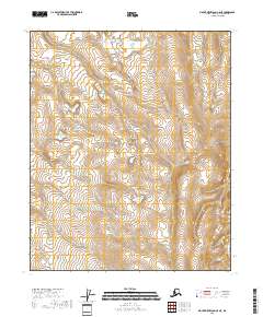
2018 Map of Mount Michelson C-5 NE
USGS Topo · Published 2018About this map
Canning Valley dominates the northeastern corner of this remote North Slope landscape, defined by an intricate network of wetlands and riverine features. This 2018 survey by the U.S. Geological Survey details a wilderness area where the natural hydrography is the primary defining characteristic. The map is organized by the Public Land Survey System, covering portions of t5n r22e, t4n r23e, and surrounding townships. Researchers and environmental historians can trace the precise contours of the tundra and the winding watercourses that characterize this Arctic environment before it undergoes further natural or human-driven change.
Find a feature on this map
7 named features on this map. Tap any name to fly to it.
Don’t see what you’re looking for? This feature index may not catch every label — zoom into the map to look around manually.
Map Details
Editions of this 2018 Mount Michelson C-5 NE Map
This is the sole edition of this map. No revisions or reprints were ever made.
Other maps of this area

1951 · Mt. Michelson
USGS Topo · 1:250,000

1955 · Mount Michelson C-5
USGS Topo · 1:63,360

1955 · Mount Michelson D-5
USGS Topo · 1:63,360

1955 · Mount Michelson C-4
USGS Topo · 1:63,360

1955 · Mount Michelson D-4
USGS Topo · 1:63,360

1956 · Mt. Michelson
USGS Topo · 1:250,000
1973 · Mount Michelson C-5
USGS Topo · 1:63,360

1978 · Mount Michelson C-4
USGS Topo · 1:63,360
2018 · Mount Michelson C-5 SE
USGS Topo · 1:25,000
2018 · Mount Michelson C-4 SW
USGS Topo · 1:25,000