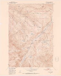
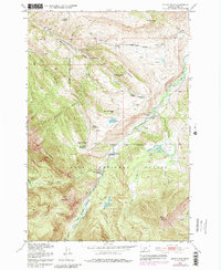
1951 Map of Mount Rae
USGS Topo · Published 1953About this map
The Gallatin National Forest dominates this early 1950s terrain, where the high ridges of the Boulder Divide separate the drainage of Little Mission Creek from the West Boulder River. This landscape captures a significant transition in land use within the Missouri River Basin development area. While the West Boulder Ranger Station and active cattle operations like the Bar Twenty Ranch and Burnt Leather Ranch suggest ongoing activity, the map is heavily marked by earlier efforts at settlement. Numerous sites are explicitly noted as abandoned, including the Bruffey Homestead, Swingley Ranch, and the Lamp Homestead. Even infrastructure follows this pattern, as seen with the West Boulder Ditch. The presence of the Gordon School among these former homesteads provides a genealogical anchor for families who once attempted to farm or ranch these mountain valleys.
Find a feature on this map
41 named features on this map. Tap any name to fly to it.
Don’t see what you’re looking for? This feature index may not catch every label — zoom into the map to look around manually.
Map Details
Editions of this 1951 Mount Rae Map
6 editions found
Other maps of this area

1891 · Livingston
USGS Topo · 1:250,000

1893 · Livingston
USGS Topo · 1:250,000

1940 · Mt. Cowen
USGS Topo · 1:62,500

1941 · Mt Douglas
USGS Topo · 1:62,500

1943 · Mt Douglas
USGS Topo · 1:62,500

1943 · Mt Cowen
USGS Topo · 1:62,500

1947 · Bozeman
USGS Topo · 1:250,000

1948 · Bozeman
USGS Topo · 1:250,000

1951 · Mount Rae
USGS Topo · 1:24,000

1951 · Livingston Peak
USGS Topo · 1:24,000