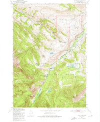
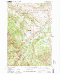
1951 Map of Mount Rae
USGS Topo · Published 1976About this map
High-country homesteads and early ranching operations characterize this 1951 survey of the West Boulder River corridor within the West Gallatin National Forest. The map documents a landscape in transition, where numerous family-named sites like the Bruffey Homestead and Swingley Ranch are already marked as abandoned, suggesting the difficulty of sustained high-altitude agriculture in the early 20th century.
Find a feature on this map
42 named features on this map. Tap any name to fly to it.
Don’t see what you’re looking for? This feature index may not catch every label — zoom into the map to look around manually.
Map Details
Editions of this 1951 Mount Rae Map
6 editions found
Other maps of this area

1891 · Livingston
USGS Topo · 1:250,000

1893 · Livingston
USGS Topo · 1:250,000

1940 · Mt. Cowen
USGS Topo · 1:62,500

1941 · Mt Douglas
USGS Topo · 1:62,500

1943 · Mt Douglas
USGS Topo · 1:62,500

1943 · Mt Cowen
USGS Topo · 1:62,500

1947 · Bozeman
USGS Topo · 1:250,000

1948 · Bozeman
USGS Topo · 1:250,000

1951 · Mount Rae
USGS Topo · 1:24,000

1951 · Livingston Peak
USGS Topo · 1:24,000