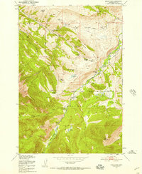
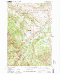
1951 Map of Mount Rae
USGS Topo · Published 1957About this map
Burnt Leather Ranch and the West Boulder Ranger Station anchor the southern reaches of this mid-century survey, where the West Boulder River cuts through the high country of the Gallatin National Forest. The landscape is a transition between the lower valley and the peaks of Mount Rae and Lion Mountain. The most striking aspect of this 1951 record is the concentration of former mountain settlements now noted as discontinued.
Find a feature on this map
50 named features on this map. Tap any name to fly to it.
Don’t see what you’re looking for? This feature index may not catch every label — zoom into the map to look around manually.
Map Details
Editions of this 1951 Mount Rae Map
6 editions found
Other maps of this area

1891 · Livingston
USGS Topo · 1:250,000

1893 · Livingston
USGS Topo · 1:250,000

1940 · Mt. Cowen
USGS Topo · 1:62,500

1941 · Mt Douglas
USGS Topo · 1:62,500

1943 · Mt Douglas
USGS Topo · 1:62,500

1943 · Mt Cowen
USGS Topo · 1:62,500

1947 · Bozeman
USGS Topo · 1:250,000

1948 · Bozeman
USGS Topo · 1:250,000

1951 · Mount Rae
USGS Topo · 1:24,000

1951 · Livingston Peak
USGS Topo · 1:24,000