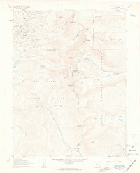
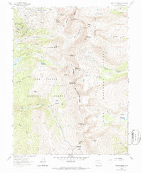
1961 Map of Mount Sherman
USGS Topo · Published 1963About this map
Ibex Mines and a network of high-altitude claims dominate the northern reaches of this Colorado landscape, reflecting an era of intense mineral extraction along the Continental Divide. Surveyed in the early 1960s, the map reveals the rugged industrial footprint of the Leadville mining district, with named sites such as the Julia Fiske Mine and Hilltop Mine perched on slopes above Iowa Gulch. The terrain is defined by the sharp boundaries of the San Isabel National Forest and Pike National Forest, which meet along the ridge lines of Mount Sherman and Mount Sheridan. A Sawmill (Aband) in the Gold Basin area points to former timber operations that once supported the local mines. Transportation follows natural grades, most notably the route through Weston Pass and unimproved dirt tracks leading toward the Ruby Mine.
Find a feature on this map
58 named features on this map. Tap any name to fly to it.
Don’t see what you’re looking for? This feature index may not catch every label — zoom into the map to look around manually.
Map Details
Editions of this 1961 Mount Sherman Map
5 editions found
Other maps of this area

1889 · Leadville
USGS Topo · 1:125,000

1891 · Leadville
USGS Topo · 1:125,000

1934 · Climax
USGS Topo · 1:48,000

1935 · Mount Elbert
USGS Topo · 1:62,500

1938 · Mt. Lincoln
USGS Topo · 1:48,000

1938 · Mount Elbert
USGS Topo · 1:62,500

1939 · Mount Elbert
USGS Topo · 1:62,500

1942 · Leadville
USGS Topo · 1:125,000

1945 · Mount Lincoln
USGS Topo · 1:62,500

1949 · Holy Cross
USGS Topo · 1:62,500