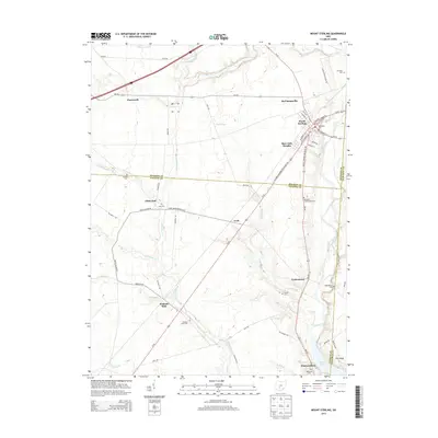
2013 Map of Mount Sterling
USGS Topo · Published 2013About this map
Mount Sterling sits at the intersection of several regional routes, serving as a primary hub for the surrounding agricultural landscape where the borders of Madison, Fayette, and Pickaway counties meet. The town's layout includes a Methodist Cem and a central Po, with residential clusters like Burr Oaks Heights and McClimansville nearby. This 2013 survey illustrates the continued importance of the Us-62 corridor, which links the northern settlements to Madison Mills and Pancoastburg in the south.
Find a feature on this map
67 named features on this map. Tap any name to fly to it.
Don’t see what you’re looking for? This feature index may not catch every label — zoom into the map to look around manually.
Map Details
Editions of this 2013 Mount Sterling Map
This is the sole edition of this map. No revisions or reprints were ever made.
Other maps of this area

1906 · Mt Sterling
USGS Topo · 1:62,500

1907 · London
USGS Topo · 1:62,500

1911 · Era
USGS Topo · 1:62,500

1913 · Era
USGS Topo · 1:62,500

1923 · West Columbus
USGS Topo · 1:62,500

1925 · West Columbus
USGS Topo · 1:62,500

1943 · Era
USGS Topo · 1:62,500

1947 · Columbus
USGS Topo · 1:250,000

1955 · Harrisburg
USGS Topo · 1:24,000
1958 · Five Points
USGS Topo · 1:24,000