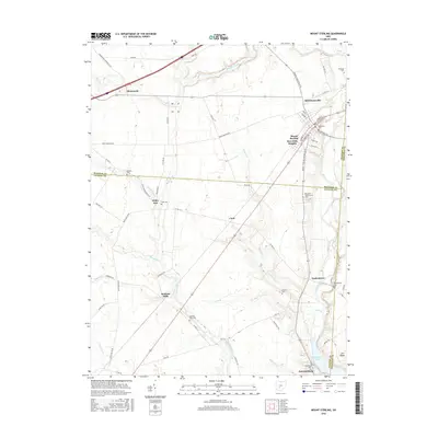
2016 Map of Mount Sterling
USGS Topo · Published 2016About this map
Mount Sterling serves as the primary hub in this central Ohio landscape, where the intersections of Madison, Fayette, and Pickaway counties meet. The area is defined by a dense network of watercourses, including the meandering Deer Creek and the North Fork Paint Creek, which dictate the placement of small agricultural settlements and family-named landmarks. Genealogists will find a wealth of burial sites scattered across the township, from the Methodist Cem in the heart of town to smaller rural grounds like the Bostwick-Loofbourrow Cem and Leavell Cem. The southern reach of the map features the expansion of Deer Creek Lake, while smaller hamlets like Madison Mills and Chenoweth remain anchored to the rural road system, including the historic Post Rd and London-Circleville Rd.
Find a feature on this map
71 named features on this map. Tap any name to fly to it.
Don’t see what you’re looking for? This feature index may not catch every label — zoom into the map to look around manually.
Map Details
Editions of this 2016 Mount Sterling Map
This is the sole edition of this map. No revisions or reprints were ever made.
Other maps of this area

1906 · Mt Sterling
USGS Topo · 1:62,500

1907 · London
USGS Topo · 1:62,500

1911 · Era
USGS Topo · 1:62,500

1913 · Era
USGS Topo · 1:62,500

1923 · West Columbus
USGS Topo · 1:62,500

1925 · West Columbus
USGS Topo · 1:62,500

1943 · Era
USGS Topo · 1:62,500

1947 · Columbus
USGS Topo · 1:250,000

1955 · Harrisburg
USGS Topo · 1:24,000
1958 · Five Points
USGS Topo · 1:24,000