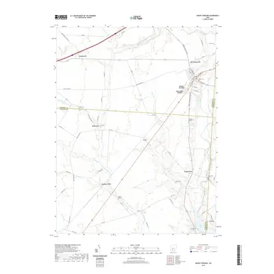
2019 Map of Mount Sterling
USGS Topo · Published 2019About this map
Mount Sterling serves as the primary hub of this landscape, situated at the junction where several regional roads converge near the northern edge of Deer Creek Lake. The map reveals a dense network of family-named cemeteries and small rural settlements that define the local genealogy of the area. Locations such as Madison Mills, Chenoweth, and Yankeetown are connected by a web of township and county highways, reflecting a longstanding agricultural and residential pattern.
Find a feature on this map
69 named features on this map. Tap any name to fly to it.
Don’t see what you’re looking for? This feature index may not catch every label — zoom into the map to look around manually.
Map Details
Editions of this 2019 Mount Sterling Map
This is the sole edition of this map. No revisions or reprints were ever made.
Other maps of this area

1906 · Mt Sterling
USGS Topo · 1:62,500

1907 · London
USGS Topo · 1:62,500

1911 · Era
USGS Topo · 1:62,500

1913 · Era
USGS Topo · 1:62,500

1923 · West Columbus
USGS Topo · 1:62,500

1925 · West Columbus
USGS Topo · 1:62,500

1943 · Era
USGS Topo · 1:62,500

1947 · Columbus
USGS Topo · 1:250,000

1955 · Harrisburg
USGS Topo · 1:24,000
1958 · Five Points
USGS Topo · 1:24,000