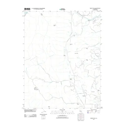
2012 Map of Mount Vaca
USGS Topo · Published 2012About this map
Pleasants Valley defines the eastern foothills of the Vaca Mountains, where established ranching land meets the ascending peaks of the Blue Ridge. This 2012 survey captures a landscape of rural homesteads and sprawling acreages such as Pioneer Ranch and Bar B Ranch. The historical footprint of the area is evident at the Rhine School site along Ulatis Creek and the settlement of Bucktown near the southern edge of the quadrangle.
Find a feature on this map
50 named features on this map. Tap any name to fly to it.
Don’t see what you’re looking for? This feature index may not catch every label — zoom into the map to look around manually.
Map Details
Editions of this 2012 Mount Vaca Map
This is the sole edition of this map. No revisions or reprints were ever made.
Other maps of this area

1902 · Napa
USGS Topo · 1:125,000

1907 · Woodland
USGS Topo · 1:62,500

1908 · Vacaville
USGS Topo · 1:62,500

1916 · Winters
USGS Topo · 1:31,680

1917 · Wolfskill
USGS Topo · 1:31,680

1917 · Elmira
USGS Topo · 1:31,680

1921 · Mt. Vaca
USGS Topo · 1:62,500

1924 · Capay
USGS Topo · 1:62,500
1941 · Vacaville
USGS Topo · 1:62,500
1941 · Woodland
USGS Topo · 1:62,500