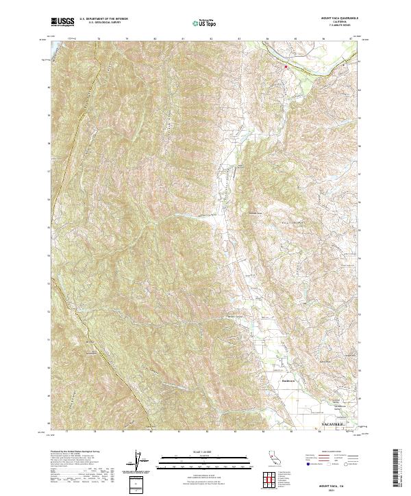
2021 Map of Mount Vaca
USGS Topo · Published 2021About this map
The Vaca Mountains rise sharply above the western edge of the Sacramento Valley, creating a high-relief boundary between Napa and Solano counties. This landscape is defined by the steep ascent to Mt Vaca and Blue Ridge, where numerous seasonal drainages like Wild Horse Canyon and Gates Canyon carve through the uplifted terrain. Below the peaks, the sheltered Pleasants Valley and Vaca Valley provide a stark contrast to the higher ridges, hosting small-scale settlements and rural aviation at Blake Sky Park.
Find a feature on this map
91 named features on this map. Tap any name to fly to it.
Don’t see what you’re looking for? This feature index may not catch every label — zoom into the map to look around manually.
Map Details
Editions of this 2021 Mount Vaca Map
This is the sole edition of this map. No revisions or reprints were ever made.
Other maps of this area

1902 · Napa
USGS Topo · 1:125,000

1907 · Woodland
USGS Topo · 1:62,500

1908 · Vacaville
USGS Topo · 1:62,500

1916 · Winters
USGS Topo · 1:31,680

1917 · Wolfskill
USGS Topo · 1:31,680

1917 · Elmira
USGS Topo · 1:31,680

1921 · Mt. Vaca
USGS Topo · 1:62,500

1924 · Capay
USGS Topo · 1:62,500
1941 · Vacaville
USGS Topo · 1:62,500
1941 · Woodland
USGS Topo · 1:62,500