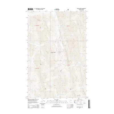
2014 Map of Mount Wright
USGS Topo · Published 2014About this map
Mt Wright and Mt Lockhart dominate the high-elevation terrain within this section of the Lewis & Clark National Forest. The landscape is defined by the complex headwaters of the Teton River, where the N Fork Teton River, W Fork N Fork Teton River, and Middle Fork N Fork Teton River converge amidst steep ridges and gulches. Significant landmarks like Teton Peak and Lonesome Ridge offer a clear look at the geological formations of Teton County, while drainage patterns such as Waldron Cr and Nesbit Cr trace the descent from the peaks toward Garners Gulch. Human presence is primarily represented through Forest Service management, indicated by the Teton Firewood Access and recreational routes like the Snowmobile Lp.
Find a feature on this map
26 named features on this map. Tap any name to fly to it.
Don’t see what you’re looking for? This feature index may not catch every label — zoom into the map to look around manually.
Map Details
Editions of this 2014 Mount Wright Map
This is the sole edition of this map. No revisions or reprints were ever made.
Other maps of this area

1903 · Saypo
USGS Topo · 1:125,000

1914 · Heart Butte
USGS Topo · 1:125,000

1918 · Heart Butte
USGS Topo · 1:125,000

1955 · Choteau
USGS Topo · 1:250,000

1957 · Choteau
USGS Topo · 1:250,000

1958 · Choteau
USGS Topo · 1:250,000

1958 · Ear Mountain
USGS Topo · 1:24,000

1958 · Cave Mountain
USGS Topo · 1:24,000

1958 · Porphyry Reef
USGS Topo · 1:24,000

1958 · Mount Wright
USGS Topo · 1:24,000