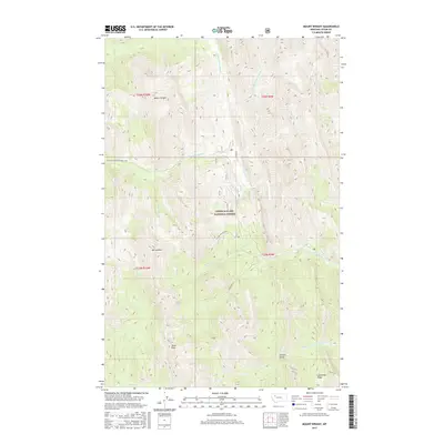
2017 Map of Mount Wright
USGS Topo · Published 2017About this map
Mount Wright and Mt Lockhart dominate this high-elevation landscape within the Lewis & Clark National Forest. The topography is defined by the complex drainage network of the North Fork Teton River, including its western, eastern, and middle forks. This area is shaped by steep ridgelines like Lonesome Ridge and deep draws such as Garners Gulch. The map reveals a specialized recreation landscape, centered on the Teton Pass Ski Area and the Snowmobile Lp trail. While largely undeveloped, the placement of these winter recreation features alongside creeks like Waldron Creek and Porcupine Creek suggests a territory managed for both conservation and seasonal tourism. Researchers can trace the hydrography from the headwaters of Route Creek and Nesbit Creek as they feed into the larger Teton River system.
Find a feature on this map
27 named features on this map. Tap any name to fly to it.
Don’t see what you’re looking for? This feature index may not catch every label — zoom into the map to look around manually.
Map Details
Editions of this 2017 Mount Wright Map
This is the sole edition of this map. No revisions or reprints were ever made.
Other maps of this area

1903 · Saypo
USGS Topo · 1:125,000

1914 · Heart Butte
USGS Topo · 1:125,000

1918 · Heart Butte
USGS Topo · 1:125,000

1955 · Choteau
USGS Topo · 1:250,000

1957 · Choteau
USGS Topo · 1:250,000

1958 · Choteau
USGS Topo · 1:250,000

1958 · Ear Mountain
USGS Topo · 1:24,000

1958 · Cave Mountain
USGS Topo · 1:24,000

1958 · Porphyry Reef
USGS Topo · 1:24,000

1958 · Mount Wright
USGS Topo · 1:24,000