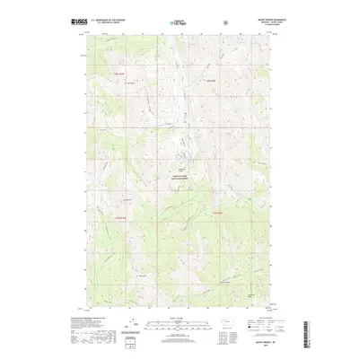
2020 Map of Mount Wright
USGS Topo · Published 2020About this map
The Sawtooth Range dominates this portion of the Lewis & Clark National Forest, where high alpine peaks and deep creek drainages define the landscape. The hydrography is centered on the N Fork Teton River and its various tributaries, including Waldron Creek and the Middle Fork North Fork Teton River. Higher elevations are marked by prominent summits like Mount Wright and Teton Peak, while geologic features such as Washboard Reef indicate the complex folding of the Rocky Mountain Front. Human passage through this wilderness is traced by routes like the Route Creek Pass and specific recreational points such as Mount Wright Hiker. The map captures a high-altitude wilderness area primarily managed for conservation and backcountry recreation, with no significant permanent settlements within its boundaries.
Find a feature on this map
41 named features on this map. Tap any name to fly to it.
Don’t see what you’re looking for? This feature index may not catch every label — zoom into the map to look around manually.
Map Details
Editions of this 2020 Mount Wright Map
This is the sole edition of this map. No revisions or reprints were ever made.
Other maps of this area

1903 · Saypo
USGS Topo · 1:125,000

1914 · Heart Butte
USGS Topo · 1:125,000

1918 · Heart Butte
USGS Topo · 1:125,000

1955 · Choteau
USGS Topo · 1:250,000

1957 · Choteau
USGS Topo · 1:250,000

1958 · Choteau
USGS Topo · 1:250,000

1958 · Ear Mountain
USGS Topo · 1:24,000

1958 · Cave Mountain
USGS Topo · 1:24,000

1958 · Porphyry Reef
USGS Topo · 1:24,000

1958 · Mount Wright
USGS Topo · 1:24,000