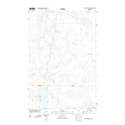
2013 Map of Mountain Ash Lake
USGS Topo · Published 2013About this map
The glacial waters of Mountain Ash Lake and Hill Lake dominate this northern Minnesota landscape, where the boundary between Itasca and Aitkin counties cuts through a dense network of wetlands and small water bodies. The terrain is defined by its many named basins, from the larger Little Pokegama Lake in the north to smaller, secluded spots like Dinner Pail Lake and Previs Lake. Human presence is marked by a sparse grid of roads and trails, including Us 169 which bisects the area, and local routes like Bear Creek Rd and Spang Rd. Of particular interest for genealogists is the Heavirland Family Cem located on the eastern side of the quadrangle, a significant local landmark. The concentration of water features like Cook Lake and Smith Lake suggests a region primarily used for timber management and outdoor recreation, characteristic of this portion of the Iron Range periphery in the early 21st century.
Find a feature on this map
34 named features on this map. Tap any name to fly to it.
Don’t see what you’re looking for? This feature index may not catch every label — zoom into the map to look around manually.
Map Details
Editions of this 2013 Mountain Ash Lake Map
This is the sole edition of this map. No revisions or reprints were ever made.
Other maps of this area

1953 · Siseebakwet Lake
USGS Topo · 1:24,000

1953 · Grand Rapids
USGS Topo · 1:24,000

1953 · Duluth
USGS Topo · 1:250,000

1954 · Hibbing
USGS Topo · 1:250,000

1957 · Hibbing
USGS Topo · 1:250,000

1958 · Hibbing
USGS Topo · 1:250,000

1958 · Duluth
USGS Topo · 1:250,000

1964 · Hibbing
USGS Topo · 1:250,000

1969 · La Prairie
USGS Topo · 1:24,000

1970 · Split Hand Lake
USGS Topo · 1:24,000