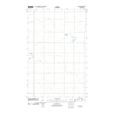
2011 Map of Mountain
USGS Topo · Published 2011About this map
Mountain occupies a central role in this northern Red River Valley landscape, characterized by the grid of section roads and the winding paths of local waterways. The settlement is defined by local thoroughfares such as Main Ave and Hill St, with the Mountain Cemetery located just to the southwest. This area of Pembina County reflects a deep-rooted agricultural tradition, evidenced by sites like Bernhoft Farms and the water management infrastructure of the Willow Creek-Park River Dam Number 1. Three primary watercourses—the Tongue River in the north, Willow Creek in the center, and Cart Creek to the south—carve through the prairie, influencing the placement of homesteads and roads across the township.
Find a feature on this map
23 named features on this map. Tap any name to fly to it.
Don’t see what you’re looking for? This feature index may not catch every label — zoom into the map to look around manually.
Map Details
Editions of this 2011 Mountain Map
This is the sole edition of this map. No revisions or reprints were ever made.
Other maps of this area

1918 · Walhalla
USGS Topo · 1:62,500

1939 · Cavalier
USGS Topo · 1:62,500

1941 · Cavalier
USGS Topo · 1:62,500

1943 · Walhalla
USGS Topo · 1:62,500

1944 · Crystal
USGS Topo · 1:62,500

1952 · Thief River Falls
USGS Topo · 1:250,000

1956 · Thief River Falls
USGS Topo · 1:250,000

1957 · Thief River Falls
USGS Topo · 1:250,000

1963 · Crystal
USGS Topo · 1:24,000

1963 · Gardar
USGS Topo · 1:24,000