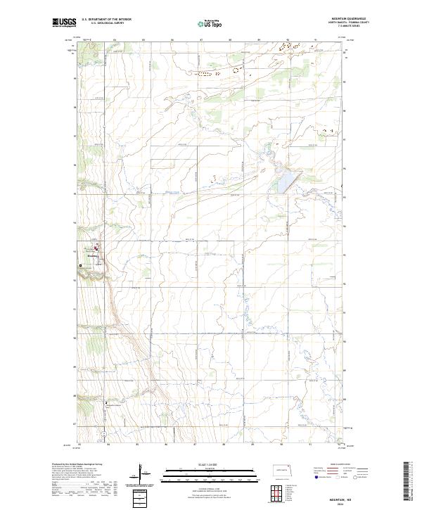
2024 Map of Mountain
USGS Topo · Published 2024About this map
Mountain serves as the primary hub of this eastern North Dakota landscape, situated at the intersection of Main St and Co Rd 3. The area's cultural and genealogical history is anchored by several religious sites, including the Vikur Lutheran Church Cem and the Mountain Cem located on the town's western edge. To the south, the Thingvalla Lutheran Cem sits along 129th Ave NE, providing a key landmark for local family research. The terrain is defined by the winding paths of Willow Creek and Cart Creek, which drain the agricultural sections across Townships 161N and 160N. A rigid grid of rural roads, such as 92nd St NE and 84th St NE, sections the prairie into the organized land survey patterns characteristic of Pembina County.
Find a feature on this map
25 named features on this map. Tap any name to fly to it.
Don’t see what you’re looking for? This feature index may not catch every label — zoom into the map to look around manually.
Map Details
Editions of this 2024 Mountain Map
This is the sole edition of this map. No revisions or reprints were ever made.
Other maps of this area

1918 · Walhalla
USGS Topo · 1:62,500

1939 · Cavalier
USGS Topo · 1:62,500

1941 · Cavalier
USGS Topo · 1:62,500

1943 · Walhalla
USGS Topo · 1:62,500

1944 · Crystal
USGS Topo · 1:62,500

1952 · Thief River Falls
USGS Topo · 1:250,000

1956 · Thief River Falls
USGS Topo · 1:250,000

1957 · Thief River Falls
USGS Topo · 1:250,000

1963 · Crystal
USGS Topo · 1:24,000

1963 · Gardar
USGS Topo · 1:24,000