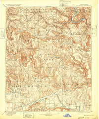
1894 Map of Mountain View
USGS Topo · Published 1932About this map
Mountain View serves as a primary anchor in this late 19th-century study of the Ozark highlands, where the White River and Little Red River carve deep drainages through Stone, Van Buren, and Cleburne counties. The terrain is defined by isolated peaks and ridges like Sugar Loaf Mountain and Candlestick Knob, which influenced the early settlement patterns of the region.
Find a feature on this map
79 named features on this map. Tap any name to fly to it.
Don’t see what you’re looking for? This feature index may not catch every label — zoom into the map to look around manually.
Map Details
Editions of this 1894 Mountain View Map
5 editions found
Other maps of this area

1890 · Batesville
USGS Topo · 1:125,000

1890 · Mountain Home
USGS Topo · 1:125,000

1891 · Mountain Home
USGS Topo · 1:125,000

1891 · Batesville
USGS Topo · 1:125,000

1892 · Marshall
USGS Topo · 1:125,000

1892 · Mountain View
USGS Topo · 1:125,000

1892 · Morrillton
USGS Topo · 1:125,000

1893 · Yellville
USGS Topo · 1:125,000

1894 · Mountain View
USGS Topo · 1:125,000

1894 · Morrillton
USGS Topo · 1:125,000