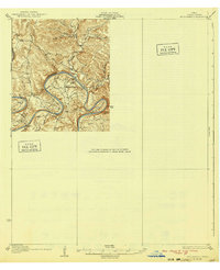
1932 Map of Mt. Bonnell
USGS Topo · Published 1940About this map
The Colorado River carves a deep, serpentine path through this 1930s landscape, creating dramatic loops at Horseshoe Bend and Arkansas Bend before the river was altered by mid-century dam projects. This pre-inundation survey captures the river's original character, defined by numerous river crossings that supported the local agricultural and ranching economy. Significant named river crossings including Watson Ford, Sylvester Ford, and Lohmann Ford indicate the historic importance of these points for transit before the establishment of modern bridges. Small community hubs are anchored by local institutions such as Hudson Bend Ch, Cox Spring Sch, and Teck Sch. The terrain is characterized by intricate drainage systems like Collier Hollow and Devil Hollow that feed into the main river channel, while landmarks like Comanche Peak rise above the surrounding canyons and bends.
Find a feature on this map
26 named features on this map. Tap any name to fly to it.
Don’t see what you’re looking for? This feature index may not catch every label — zoom into the map to look around manually.
Map Details
Editions of this 1932 Mt. Bonnell Map
2 editions found

Other maps of this area

1887 · Blanco
USGS Topo · 1:125,000

1887 · Burnet
USGS Topo · 1:125,000

1893 · Georgetown
USGS Topo · 1:125,000

1893 · Burnet
USGS Topo · 1:125,000

1894 · Blanco
USGS Topo · 1:125,000

1896 · Austin
USGS Topo · 1:125,000

1897 · Austin
USGS Topo · 1:125,000

1903 · Burnet
USGS Topo · 1:125,000

1909 · Burnet
USGS Topo · 1:125,000

1910 · Austin
USGS Topo · 1:125,000