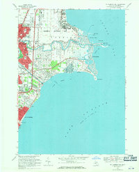
1968 Map of Mt Clemens East
USGS Topo · Published 1971About this map
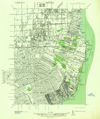
Selfridge Air Force Base dominates the shoreline of Anchor Bay, marking a significant military presence in Macomb County during the late 1960s. The map illustrates the complex water management of the region, where the Clinton River meets Lake St Clair via a system of channels, a Spillway, and even an Aqueduct. The residential expansion of Mt. Clemens and St Clair Shores is evident through the dense grid of streets and numerous educational institutions like L'Anse Creuse High Sch and Christian Clemens Sch. Recreational development is equally prominent, featuring the Gowanie Country Club and the extensive Metropolitan Beach park area. This survey reveals a landscape transitioned from its maritime roots into a bustling suburban and military corridor, with small shoreline communities like St Clair Haven and Lakeside positioned along the evolving waterfront.
Find a feature on this map
71 named features on this map. Tap any name to fly to it.
Don’t see what you’re looking for? This feature index may not catch every label — zoom into the map to look around manually.
Map Details
Editions of this 1968 Mt Clemens East Map
4 editions found
Other maps of this area

1905 · Grosse Pointe
USGS Topo · 1:62,500

1912 · Mt Clemens
USGS Topo · 1:62,500

1914 · Algonac
USGS Topo · 1:62,500

1918 · Grosse Pointe
USGS Topo · 1:62,500

1929 · Mt Clemens
USGS Topo · 1:62,500

1936 · New Haven
USGS Topo · 1:31,680

1936 · Waldenburg
USGS Topo · 1:31,680

1936 · Selfridge Field
USGS Topo · 1:31,680

1936 · New Baltimore
USGS Topo · 1:31,680
1936 · Grosse Pointe
USGS Topo · 1:31,680
Featured Places
- Clinton Township, MI
- Saint Clair Shores, MI
- Harrison Township, MI
- Mount Clemens, MI
- Saint Clair Haven, Harrison Township