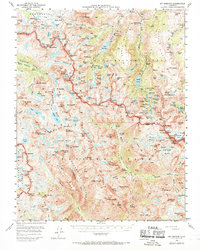
1957 Map of Mt. Goddard
USGS Topo · Published 1970About this map
The high Sierra Nevada backcountry of Fresno and Inyo counties is documented here in detail, captured during a period of mid-century survey work based on late-1940s aerial photography. High-altitude glacial features dominate the landscape, from the Glacier Divide and Goethe Glacier to the sharp peaks of Mt Goddard and Mt Darwin. The survey traces the course of the John Muir Trail as it winds through Evolution Valley, passing through the remote Colby Meadow and McClure Meadow. Human industrial footprints appear in the eastern reaches, where the Schober Mine, Merrill Prospect, and Lindner Prospect indicate early prospecting efforts near the waters of Lake Sabrina and the North Fork Bishop Creek. This map preserves the wilderness corridor as it existed before the modern era of high-impact recreation, marking traditional routes through Piute Pass and along the Palisade Trail.
Find a feature on this map
197 named features on this map. Tap any name to fly to it.
Don’t see what you’re looking for? This feature index may not catch every label — zoom into the map to look around manually.
Map Details
Editions of this 1957 Mt. Goddard Map
3 editions found
Other maps of this area

1903 · Tehipite
USGS Topo · 1:125,000

1905 · Tehipite
USGS Topo · 1:125,000

1907 · Mt. Whitney
USGS Topo · 1:125,000

1912 · Mt. Goddard
USGS Topo · 1:125,000

1913 · Bishop
USGS Topo · 1:125,000

1919 · Mt. Whitney
USGS Topo · 1:125,000

1937 · Mt. Whitney
USGS Topo · 1:125,000

1947 · Mariposa
USGS Topo · 1:250,000

1948 · Fresno
USGS Topo · 1:250,000

1948 · Mariposa
USGS Topo · 1:250,000