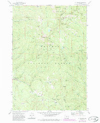
1972 Map of Mt. Ireland
USGS Topo · Published 1985About this map
Whitman National Forest dominates the landscape of this Grant and Baker County border region, showcasing an extensive network of 19th and early 20th-century lode mining operations. The crest of the Blue Mountains is marked by the Mt Ireland Lookout, which oversees a high-elevation terrain etched with named gulches and alpine meadows like Mahoney Mdws and Gold Center Meadow. The dense concentration of extraction sites, including the California Mine, Imperial Eagle Mine, and the Mormon Boy Mine, illustrates the intensity of the gold and silver rushes that once defined this area.
Find a feature on this map
80 named features on this map. Tap any name to fly to it.
Don’t see what you’re looking for? This feature index may not catch every label — zoom into the map to look around manually.
Map Details
Editions of this 1972 Mt. Ireland Map
2 editions found
Other maps of this area

1901 · Sumpter
USGS Topo · 1:125,000

1955 · Canyon City
USGS Topo · 1:250,000

1959 · Canyon City
USGS Topo · 1:250,000

1961 · Whitney
USGS Topo · 1:24,000

1972 · Trout Meadows
USGS Topo · 1:24,000

1972 · Mt. Ireland
USGS Topo · 1:24,000
1972 · Bourne
USGS Topo · 1:24,000
1972 · Granite
USGS Topo · 1:24,000
1972 · Sumpter
USGS Topo · 1:24,000

1972 · Greenhorn
USGS Topo · 1:24,000