
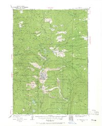
1927 Map of Mt. Jefferson
USGS Topo · Published 1956About this map
Mt Jefferson dominates this 1927 survey, standing at the junction of several county lines and national forests. The map illustrates a high-altitude wilderness before extensive modern road development, where movement relied on the Skyline Trail and its connection to various remote outposts. A network of administrative stations, including Lemiti Ranger Sta, Camas Prairie Ranger Sta, and Old Mill Ranger Sta, highlights the early 20th-century management of the Mount Hood National Forest and Santiam National Forest.
Find a feature on this map
205 named features on this map. Tap any name to fly to it.
Don’t see what you’re looking for? This feature index may not catch every label — zoom into the map to look around manually.
Map Details
Editions of this 1927 Mt. Jefferson Map
2 editions found
Other maps of this area

1916 · Estacada
USGS Topo · 1:125,000

1924 · Mount Hood
USGS Topo · 1:125,000

1926 · Bend
USGS Topo · 1:125,000

1927 · Mount Hood
USGS Topo · 1:125,000

1928 · Madras
USGS Topo · 1:125,000

1929 · Mill City
USGS Topo · 1:125,000

1929 · Bend
USGS Topo · 1:125,000

1929 · Three Sisters
USGS Topo · 1:125,000

1930 · Mt. Jefferson
USGS Topo · 1:125,000

1930 · Dufur
USGS Topo · 1:125,000