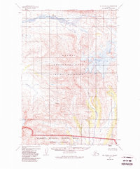
1951 Map of Mt. Katmai A-5
USGS Topo · Published 1985About this map
Mt Martin dominates the northeastern corner of this 1951 topographic survey, marking a significant high point within the Katmai National Park and Katmai Wilderness. The landscape is defined by the drainage systems of Angle Creek in the north and the Kejulik River to the south, which flows through the rugged corridor of Kejulik Pass. This edition documents the region as it was surveyed in the early 1950s, though it includes later administrative updates from 1984 regarding federal land boundaries.
Find a feature on this map
10 named features on this map. Tap any name to fly to it.
Don’t see what you’re looking for? This feature index may not catch every label — zoom into the map to look around manually.
Map Details
Editions of this 1951 Mt. Katmai A-5 Map
3 editions found

Other maps of this area

1948 · Mt Katmai
USGS Topo · 1:250,000

1951 · Mt Katmai
USGS Topo · 1:250,000

1951 · Karluk
USGS Topo · 1:250,000

1951 · Mount Katmai A-6
USGS Topo · 1:63,360

1951 · Mount Katmai B-4
USGS Topo · 1:63,360

1951 · Mount Katmai B-6
USGS Topo · 1:63,360

1951 · Karluk D-6
USGS Topo · 1:63,360

1951 · Karluk D-4
USGS Topo · 1:63,360

1951 · Mount Katmai A-4
USGS Topo · 1:63,360

1951 · Karluk D-5
USGS Topo · 1:63,360