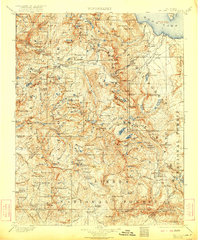
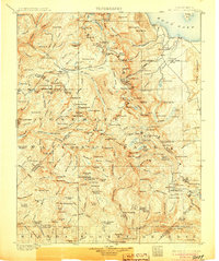
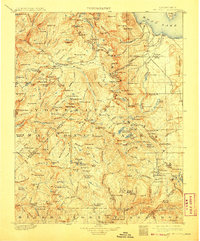
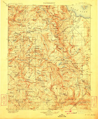
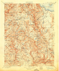
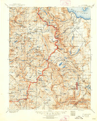
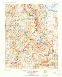
1901 Map of Mt. Lyell
USGS Topo · Published 1922About this map
Mt Lyell and the high ridges of the central Sierra Nevada are captured here as they appeared during the 1898-99 surveys by R.B. Marshall and H.E.C. Feusier. The landscape is defined by the intersections of Yosemite National Park, Sierra National Forest, and Mono National Forest. Significant glacial features, including the Lyell Glacier and Conness Glacier, crown the peaks, feeding the headwaters of the Merced River and the San Joaquin River. The map illustrates a high-altitude wilderness at the turn of the century, where early administrative markers like the Clover Meadow Ranger Sta and seasonal livestock areas such as Sheep Crossing and Cargyle Meadow hint at the era's grazing and conservation efforts. From the expansive Tuolumne Meadows to the distinct geological formation of the Devil Postpile, the topography reflects a world of early mountaineering and natural resource management before the widespread development of modern recreational infrastructure.
Find a feature on this map
167 named features on this map. Tap any name to fly to it.
Don’t see what you’re looking for? This feature index may not catch every label — zoom into the map to look around manually.
Map Details
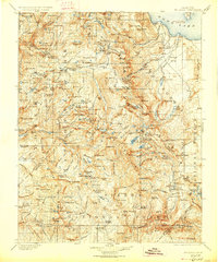
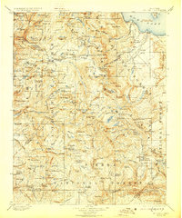
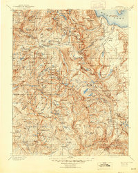
Editions of this 1901 Mt. Lyell Map
12 editions found

1901 edition
16.5 x 19.9 inches
1905 edition
16.6 x 19.8 inches
1908 edition
16.5 x 20 inches
1910 edition
16.5 x 19.9 inches
1914 edition
16.5 x 19.8 inches
1922 edition
16.5 x 19.8 inches
1927 edition
16.5 x 19.9 inches
1929 edition
16.5 x 19.9 inches
1944 edition
16.6 x 20.7 inches
1948 edition
16.6 x 20.7 inches
1950 edition
16.6 x 20.7 inches

1950 edition
16.5 x 20.8 inches
Other maps of this area

1896 · Dardanelles
USGS Topo · 1:125,000

1897 · Yosemite
USGS Topo · 1:125,000

1898 · Dardanelles
USGS Topo · 1:125,000

1900 · Yosemite
USGS Topo · 1:125,000
1901 · Mt. Lyell
USGS Topo · 1:125,000

1903 · Yosemite
USGS Topo · 1:125,000

1904 · Kaiser
USGS Topo · 1:125,000

1909 · Yosemite
USGS Topo · 1:125,000

1909 · Hawthorne
USGS Topo · 1:250,000

1909 · Bridgeport
USGS Topo · 1:125,000