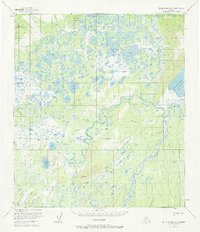
1953 Map of Mt. McKinley D-4
USGS Topo · Published 1968About this map
The McKinley River and Kantishna River converge in this remote subarctic landscape, where a complex network of wetlands and meandering waterways dominates the interior terrain. A singular Sled Road winds through the central valley, providing a vital winter transportation route across the swampy lowlands south of Sevenmile Hill. This corridor connects several large freshwater bodies, including Chilchukabena Lake and the expansive Starr Lake.
Find a feature on this map
17 named features on this map. Tap any name to fly to it.
Don’t see what you’re looking for? This feature index may not catch every label — zoom into the map to look around manually.
Map Details
Editions of this 1953 Mt. McKinley D-4 Map
2 editions found

Other maps of this area

1948 · Kantishna River
USGS Topo · 1:250,000

1951 · Kantishna River
USGS Topo · 1:250,000

1952 · Mount McKinley
USGS Topo · 1:250,000

1952 · Kantishna River A-3
USGS Topo · 1:63,360

1952 · Kantishna River
USGS Topo · 1:250,000

1952 · Mount McKinley C-3
USGS Topo · 1:63,360

1952 · Kantishna River A-5
USGS Topo · 1:63,360

1952 · Mount McKinley D-3
USGS Topo · 1:63,360

1953 · Mount McKinley C-5
USGS Topo · 1:63,360

1953 · Kantishna River A-4
USGS Topo · 1:63,360