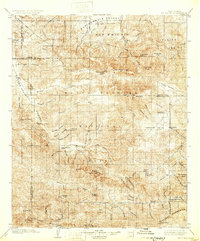
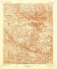
1903 Map of Mt. Pinos
USGS Topo · Published 1932About this map
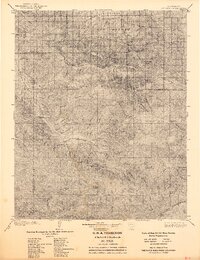
Santa Barbara National Forest dominates this 1903 survey, revealing the complex drainage basins of the Cuyama River and Sespe Creek. The high-altitude landscape is punctuated by massive peaks including Mt. Pinos and Reyes Peak, where the timbered reaches of Pine Mountain meet the high valleys. Early twentieth-century industrial activity is evidenced by the Frazier Borax Mine in the northern hills, while small settlements like Pattiway and Ozena mark the limited reach of permanent habitation in this interior wilderness. Local geography is further defined by landmarks like the Pine Mtn Lodge and the geothermal interest of Wheeler Springs. The map serves as an essential record of the original boundaries of several California counties, showing the intersections of Kern, Ventura, Santa Barbara, and San Luis Obispo as they were surveyed at the turn of the century.
Find a feature on this map
77 named features on this map. Tap any name to fly to it.
Don’t see what you’re looking for? This feature index may not catch every label — zoom into the map to look around manually.
Map Details
Editions of this 1903 Mt. Pinos Map
7 editions found
Other maps of this area

1900 · Piru
USGS Topo · 1:62,500

1902 · Santa Ynez
USGS Topo · 1:125,000

1903 · Santa Paula
USGS Topo · 1:62,500

1903 · Mt. Pinos
USGS Topo · 1:125,000

1903 · Tejon
USGS Topo · 1:125,000

1903 · Camulos
USGS Topo · 1:125,000

1904 · Ventura
USGS Topo · 1:62,500

1905 · Santa Ynez
USGS Topo · 1:125,000

1910 · Buena Vista Lake
USGS Topo · 1:125,000

1912 · McKittrick
USGS Topo · 1:125,000