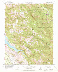
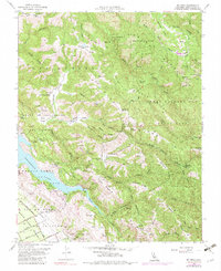
1955 Map of Mt. Sizer
USGS Topo · Published 1972About this map
Henry Willard Coe State Park dominates the mountainous terrain east of the burgeoning Santa Clara Valley during the mid-20th century. This area is characterized by a network of steep canyons and ridges, including Mt Sizer and the prominent Middle Ridge, where cattle ranching traditions are evident at Los Huecos Ranch and Coe Ranch. The landscape reflects a period of transition as the Anderson Reservoir alters the flow of Coyote Creek, creating a significant water feature near the historic Cochrane Bridge. Researchers will find numerous remote outposts and springs, such as Madrone Soda Sprs and Oak Flat Ranch, which highlight the era's land use before widespread modern development. The eastern portion of the map remains largely roadless, defined by namesake flats like Poverty Flat and Sizer Flat connected by a series of primitive jeep trails.
Find a feature on this map
81 named features on this map. Tap any name to fly to it.
Don’t see what you’re looking for? This feature index may not catch every label — zoom into the map to look around manually.
Map Details
Editions of this 1955 Mt. Sizer Map
5 editions found
Other maps of this area

1897 · Mt. Hamilton
USGS Topo · 1:62,500

1917 · Morgan Hill
USGS Topo · 1:62,500

1921 · Gilroy Hot Springs
USGS Topo · 1:62,500

1938 · Mt. Boardman
USGS Topo · 1:62,500

1939 · Morgan Hill
USGS Topo · 1:62,500

1939 · Gilroy Hot Springs
USGS Topo · 1:62,500

1940 · Gilroy Hot Springs
USGS Topo · 1:62,500

1941 · Morgan Hill
USGS Topo · 1:62,500

1942 · Mt. Hamilton
USGS Topo · 1:62,500

1942 · Mt. Boardman
USGS Topo · 1:62,500