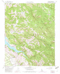
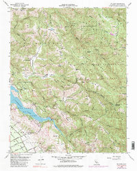
1955 Map of Mt. Sizer
USGS Topo · Published 1983About this map
Henry Willard Coe State Park dominates this mid-century topographic record, preserving a landscape of steep ridges and deep canyons before the expansion of nearby Silicon Valley. The map documents an era when the Diablo Range was defined by working cattle operations and remote outposts, including Los Huecos Ranch, Coe Ranch, and Oak Flat Ranch. The complex drainage of Coyote Creek and its many tributaries, such as Middle Fork Coyote Creek and Little Coyote Creek, carves through prominent formations like Bollinger Ridge and Fitzgerald Ridge.
Find a feature on this map
79 named features on this map. Tap any name to fly to it.
Don’t see what you’re looking for? This feature index may not catch every label — zoom into the map to look around manually.
Map Details
Editions of this 1955 Mt. Sizer Map
5 editions found
Other maps of this area

1897 · Mt. Hamilton
USGS Topo · 1:62,500

1917 · Morgan Hill
USGS Topo · 1:62,500

1921 · Gilroy Hot Springs
USGS Topo · 1:62,500

1938 · Mt. Boardman
USGS Topo · 1:62,500

1939 · Morgan Hill
USGS Topo · 1:62,500

1939 · Gilroy Hot Springs
USGS Topo · 1:62,500

1940 · Gilroy Hot Springs
USGS Topo · 1:62,500

1941 · Morgan Hill
USGS Topo · 1:62,500

1942 · Mt. Hamilton
USGS Topo · 1:62,500

1942 · Mt. Boardman
USGS Topo · 1:62,500