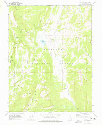
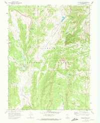
1968 Map of Mt Terrill
USGS Topo · Published 1978About this map
Fishlake National Forest dominates this high-altitude landscape of central Utah, surveyed in the late 1960s. The map centers on the infrastructure of land management and natural resource use, anchored by the Mt Terrill Guard Station and the Mt Terrill Radio Tower. The presence of a Sawmill on Sevenmile Creek and various jeep trails throughout the terrain suggest a mid-century period of active timber and range oversight. Significant water management is visible at the Lost Creek Reservoir, while numerous natural sources like Petes Hole Spring, Spirit Spring, and Cold Spring dot the slopes of Boobe Hole Mountain. To the south, the terrain rises toward the Hightop Plateau, a massive feature that overlooks the alpine waters of Snow Lake and Lake Louise. This survey provides a record of the remote high-country landscape before modern development, marking historical routes like Cedrics Dugway and the high point at Mt Terrill.
Find a feature on this map
40 named features on this map. Tap any name to fly to it.
Don’t see what you’re looking for? This feature index may not catch every label — zoom into the map to look around manually.
Map Details
Editions of this 1968 Mt Terrill Map
2 editions found
Other maps of this area

1885 · Fish Lake
USGS Topo · 1:250,000

1896 · Fish Lake
USGS Topo · 1:250,000

1956 · Salina
USGS Topo · 1:250,000

1960 · Salina
USGS Topo · 1:250,000

1962 · Salina
USGS Topo · 1:250,000
1966 · Rex Reservoir
USGS Topo · 1:24,000

1966 · Yogo Creek
USGS Topo · 1:24,000
1966 · Gooseberry Creek
USGS Topo · 1:24,000

1968 · Fish Lake
USGS Topo · 1:24,000
1968 · Hilgard Mtn
USGS Topo · 1:24,000