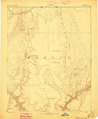
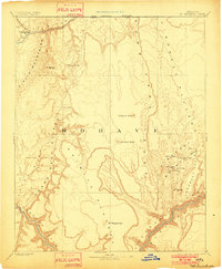
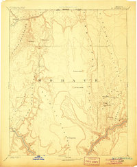
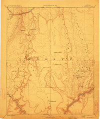
1892 Map of Mt. Trumbull
USGS Topo · Published 1897About this map
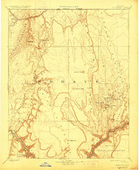
The Colorado River and its massive canyon systems define this late 19th-century survey of northwestern Arizona. Long before the region was reshaped by modern infrastructure, the landscape was charted by the Powell Survey, emphasizing the dramatic verticality of features like Hurricane Ledge and the Grand Wash Cliffs. This period of exploration captures the remote territory of Mohave when travel was dictated by scattered water sources such as Pakoon Spring, Cane Spring, and Witch Pool.
Find a feature on this map
27 named features on this map. Tap any name to fly to it.
Don’t see what you’re looking for? This feature index may not catch every label — zoom into the map to look around manually.
Map Details
Editions of this 1892 Mt. Trumbull Map
6 editions found

Other maps of this area

1885 · St. George
USGS Topo · 1:250,000

1885 · Pioche
USGS Topo · 1:250,000

1886 · Diamond Creek
USGS Topo · 1:250,000

1886 · Camp Mohave
USGS Topo · 1:250,000

1886 · Kanab
USGS Topo · 1:250,000

1886 · Saint Thomas
USGS Topo · 1:250,000

1886 · Mt. Trumbull
USGS Topo · 1:250,000

1886 · Chino
USGS Topo · 1:250,000

1886 · Pioche
USGS Topo · 1:250,000

1886 · Kaibab
USGS Topo · 1:250,000