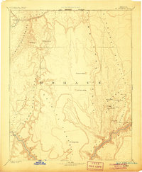
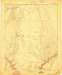
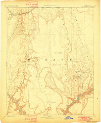
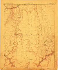
1892 Map of Mt. Trumbull
USGS Topo · Published 1906About this map
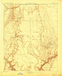
The Colorado River carves its way through this high desert territory in northwestern Mohave County, during an era of early exploration led by the Powell Survey. The landscape is defined by massive geographic barriers, most notably the Hurricane Edge and the Grand Wash Cliffs, which separate the Shiwits Plateau from the surrounding lowlands. Water sources are the primary indicators of human activity and survival in this arid environment, marked by isolated points such as Pakoon Spring, Cane Spring, and the curiously named Witch Pool.
Find a feature on this map
26 named features on this map. Tap any name to fly to it.
Don’t see what you’re looking for? This feature index may not catch every label — zoom into the map to look around manually.
Map Details
Editions of this 1892 Mt. Trumbull Map
6 editions found

Other maps of this area

1885 · St. George
USGS Topo · 1:250,000

1885 · Pioche
USGS Topo · 1:250,000

1886 · Diamond Creek
USGS Topo · 1:250,000

1886 · Camp Mohave
USGS Topo · 1:250,000

1886 · Kanab
USGS Topo · 1:250,000

1886 · Saint Thomas
USGS Topo · 1:250,000

1886 · Mt. Trumbull
USGS Topo · 1:250,000

1886 · Chino
USGS Topo · 1:250,000

1886 · Pioche
USGS Topo · 1:250,000

1886 · Kaibab
USGS Topo · 1:250,000