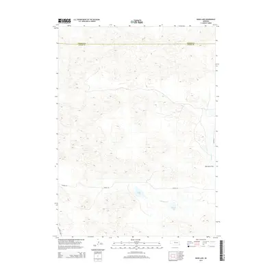
2014 Map of Mudd Lake
USGS Topo · Published 2014About this map
Mudd Lake and Philpott Lake sit within a landscape defined by the shifting dunes of the Nebraska Sandhills. This 2014 survey documents a portion of the region along the border of Thomas and Logan counties, where water is the primary geographic focal point. The ephemeral flow of Wild Horse Cr cuts through the terrain, leading toward the broad expanse of Wild Horse Flats to the east. Human infrastructure is limited to the periphery, with Us-83 clipping the southwestern corner and the unpaved corridor of Dunning Rd providing the main east-west passage through the hills. This map illustrates the intersection of high plains hydrology and the remote cattle-ranching territory of central Nebraska.
Find a feature on this map
7 named features on this map. Tap any name to fly to it.
Don’t see what you’re looking for? This feature index may not catch every label — zoom into the map to look around manually.
Map Details
Editions of this 2014 Mudd Lake Map
This is the sole edition of this map. No revisions or reprints were ever made.
Other maps of this area

1948 · Thedford
USGS Topo · 1:62,500

1948 · Halsey
USGS Topo · 1:62,500

1949 · Cody Lake
USGS Topo · 1:62,500

1950 · Thedford
USGS Topo · 1:62,500

1950 · Halsey
USGS Topo · 1:62,500

1951 · Cody Lake
USGS Topo · 1:62,500

1951 · Hoagland
USGS Topo · 1:62,500

1954 · North Platte
USGS Topo · 1:250,000

1956 · North Platte
USGS Topo · 1:250,000

1957 · North Platte
USGS Topo · 1:250,000