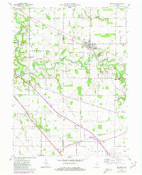
1961 Map of Mulberry
USGS Topo · Published 1980About this map
The Norfolk and Western Railroad defines the industrial and transit corridor of this Central Indiana landscape, cutting a diagonal path through the townships of Sheffield, Madison, and Washington. The town of Mulberry serves as a primary hub, while smaller nodes like Wyandot, Monroe, and Fickle reflect the scattered nature of rural rail-era development. A unique historical marker, the Treaty Indian Boundary Old Road, bisects the western portion of the map, providing a tangible link to earlier frontier negotiations and survey lines.
Find a feature on this map
39 named features on this map. Tap any name to fly to it.
Don’t see what you’re looking for? This feature index may not catch every label — zoom into the map to look around manually.
Map Details
Editions of this 1961 Mulberry Map
Other maps of this area

1953 · Danville
USGS Topo · 1:250,000

1955 · Danville
USGS Topo · 1:250,000

1956 · Danville
USGS Topo · 1:250,000

1958 · Kirkpatrick
USGS Topo · 1:24,000

1961 · Mulberry
USGS Topo · 1:24,000

1961 · Pyrmont
USGS Topo · 1:24,000

1961 · Stockwell
USGS Topo · 1:24,000

1961 · Lafayette East
USGS Topo · 1:24,000

1961 · Rossville
USGS Topo · 1:24,000

1961 · Frankfort
USGS Topo · 1:24,000