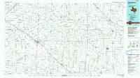
1985 Map of Muleshoe
USGS Topo · Published 1992About this map
The High Plains of the Texas Panhandle define this mid-1980s landscape, where the town of Muleshoe serves as a central hub at the junction of rail and road. The terrain is characterized by the ephemeral drainage systems of Running Water Draw and Blackwater Draw, which cut across a grid of agricultural sections. These seasonal watercourses, along with localized depressions like Coyote Lake and Baileyboro Lake, dictate the placement of smaller agrarian settlements such as Lazbuddie, Earth, and Springlake.
Find a feature on this map
38 named features on this map. Tap any name to fly to it.
Don’t see what you’re looking for? This feature index may not catch every label — zoom into the map to look around manually.
Map Details
Editions of this 1985 Muleshoe Map
2 editions found

Other maps of this area

1954 · Lubbock
USGS Topo · 1:250,000

1954 · Plainview
USGS Topo · 1:250,000

1954 · Clovis
USGS Topo · 1:250,000

1954 · Brownfield
USGS Topo · 1:250,000

1957 · Anton
USGS Topo · 1:62,500

1957 · Clovis
USGS Topo · 1:62,500

1957 · Arch
USGS Topo · 1:62,500

1957 · Abernathy
USGS Topo · 1:62,500

1957 · Pleasant Hill
USGS Topo · 1:62,500

1958 · Brownfield
USGS Topo · 1:250,000