
1985 Map of Muleshoe
USGS Topo · Published 1985About this map
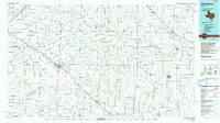
The expansive High Plains of the Texas Panhandle and South Plains are defined here by a rigid grid of agricultural roads and the critical paths of ephemeral watercourses. Muleshoe serves as a central hub, where the Atchison Topeka and Santa Fe railroad cuts a diagonal line across the landscape, linking settlements like Lariat and Sudan. The drainage patterns of Running Water Draw and Blackwater Draw reveal the natural topography that underlies the intensive farming operations of the region.
Find a feature on this map
46 named features on this map. Tap any name to fly to it.
Don’t see what you’re looking for? This feature index may not catch every label — zoom into the map to look around manually.
Map Details
Editions of this 1985 Muleshoe Map
2 editions found
Other maps of this area

1954 · Lubbock
USGS Topo · 1:250,000

1954 · Plainview
USGS Topo · 1:250,000

1954 · Clovis
USGS Topo · 1:250,000

1954 · Brownfield
USGS Topo · 1:250,000

1957 · Anton
USGS Topo · 1:62,500

1957 · Clovis
USGS Topo · 1:62,500

1957 · Arch
USGS Topo · 1:62,500

1957 · Abernathy
USGS Topo · 1:62,500

1957 · Pleasant Hill
USGS Topo · 1:62,500

1958 · Brownfield
USGS Topo · 1:250,000