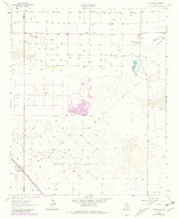
1962 Map of Muleshoe NE
USGS Topo · Published 1981About this map
Pleasant Valley Community House and Nickels Gin anchor the social and industrial life of this Llano Estacado landscape, situated along the county line between Bailey and Lamb counties. This map, featuring data from 1962 with updates through 1979, illustrates a high plains economy transitioning through the mid-20th century, defined by extensive irrigation wells and the presence of the Panhandle and Santa Fe railroad corridor. The natural geography is dominated by the ephemeral drainage of Blackwater Draw, which cuts across the northern terrain, and the alkaline basin of Soda Lake. Scattered Sandpits and a prominent Radio Tower indicate the development of local infrastructure, while numerous Jeep Trails and a private Landing Strip provide the primary means of navigating the expansive, flat farm and ranch lands.
Find a feature on this map
15 named features on this map. Tap any name to fly to it.
Don’t see what you’re looking for? This feature index may not catch every label — zoom into the map to look around manually.
Map Details
Editions of this 1962 Muleshoe NE Map
2 editions found
Other maps of this area

1954 · Clovis
USGS Topo · 1:250,000

1958 · Clovis
USGS Topo · 1:250,000

1962 · Muleshoe
USGS Topo · 1:24,000

1962 · Needmore
USGS Topo · 1:24,000

1962 · Amherst
USGS Topo · 1:24,000

1962 · Sudan
USGS Topo · 1:24,000

1962 · Muleshoe NE
USGS Topo · 1:24,000

1963 · Earth
USGS Topo · 1:24,000

1963 · Dodd
USGS Topo · 1:24,000

1963 · Lazbuddie SW
USGS Topo · 1:24,000