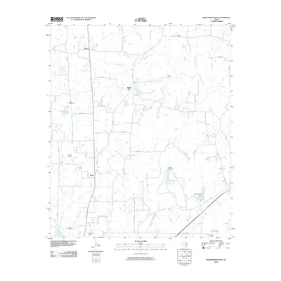
2010 Map of Murchison West
USGS Topo · Published 2010About this map
Walton, Sumer Hill, and Bethel serve as the primary focal points of this Henderson County landscape, which is defined by a dense network of watercourses and reservoirs. The drainage system is particularly intricate, with Kickapoo Creek and Pottawatomie Creek winding through the northern reaches, while Third Caney Creek and Second Caney Creek traverse the central and southern sections. This 2010 survey illustrates the region's reliance on managed water resources, evidenced by numerous named dams such as the Tiner Lake Dam and N M Jackson Dam. Local history and genealogy are anchored by sites like Liberty Cemetery and Ray Cemetery, providing points of continuity in a landscape that also includes modern infrastructure like the Stepp Airport. The road network, including the Bankhead route, connects these rural settlements and water bodies into a coherent community structure.
Find a feature on this map
64 named features on this map. Tap any name to fly to it.
Don’t see what you’re looking for? This feature index may not catch every label — zoom into the map to look around manually.
Map Details
Editions of this 2010 Murchison West Map
This is the sole edition of this map. No revisions or reprints were ever made.
Other maps of this area

1948 · Brownsboro
USGS Topo · 1:62,500

1948 · Martins Mill
USGS Topo · 1:62,500

1949 · Martins Mill
USGS Topo · 1:62,500

1949 · Brownsboro
USGS Topo · 1:62,500

1949 · Frankston
USGS Topo · 1:62,500

1949 · Athens
USGS Topo · 1:62,500

1950 · Athens
USGS Topo · 1:62,500

1950 · Frankston
USGS Topo · 1:62,500

1956 · Tyler
USGS Topo · 1:250,000

1984 · Tyler
USGS Topo · 1:250,000