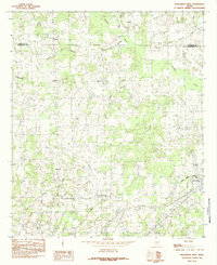
1984 Map of Murchison West
USGS Topo · Published 1984About this map
The boundary between Van Zandt and Henderson Counties cuts across a landscape defined by an intricate network of waterways during the late 1970s and early 1980s. The settlement of Murchison stands as the primary hub in the southeast, situated near the headwaters of Little Duncan Branch. Further west, the crossroads at Bethel and Walton mark the rural social centers of the day. A diverse hydrology shapes the terrain, from the winding path of Kickapoo Creek to the southern drainages of Caney Creek, Second Creek, and Third Creek. This survey captures a moment when the regional infrastructure included established local markers like the Roadside Park and the waters of Jackson Lake, providing a clear view of the agricultural and residential patterns before further modern expansion altered these East Texas communities.
Find a feature on this map
18 named features on this map. Tap any name to fly to it.
Don’t see what you’re looking for? This feature index may not catch every label — zoom into the map to look around manually.
Map Details
Editions of this 1984 Murchison West Map
This is the sole edition of this map. No revisions or reprints were ever made.
Other maps of this area

1948 · Brownsboro
USGS Topo · 1:62,500

1948 · Martins Mill
USGS Topo · 1:62,500

1949 · Martins Mill
USGS Topo · 1:62,500

1949 · Brownsboro
USGS Topo · 1:62,500

1949 · Frankston
USGS Topo · 1:62,500

1949 · Athens
USGS Topo · 1:62,500

1950 · Athens
USGS Topo · 1:62,500

1950 · Frankston
USGS Topo · 1:62,500

1956 · Tyler
USGS Topo · 1:250,000

1984 · Tyler
USGS Topo · 1:250,000